Phase 2 - Data Processing
MMQGIS plugin was used to generate the points for primary and secondary schools from the csv file obtained from data.gov.sg. The population data was then cleaned and joined using QGIS DB Manager.
The livability of a location depends on various factors that are crucial to an individual’s growth, physical and mental wellbeing. Such factors include ease of connectivity, availability of education, healthcare, and food. Therefore, eleven factors were chosen as points of interest to be analyzed and they are listed in the table below. Each factor was clipped using the 600-meter Service Area from the MRT Station Exits.
Factors |
|---|
Taxi 🚕 |
SuperMarkets 🛒 🏪 |
Secondary School 👩 🧑 🏫 |
Primary School 🧒 👧 🏫 |
PreSchool 👶 🏫 |
ElderCare 👵 |
BusStop 🚏 |
Bank 🏦 |
Food 🍛 🥐 |
Mall 🏬 |
Clinic 🏥 |
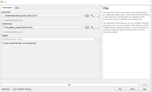
After each individual factor was clipped, it was saved in a GeoPackage with the right projection, "EPSG:3414 - SVY21 / Singapore TM," under the name "SG_1Nov2022"
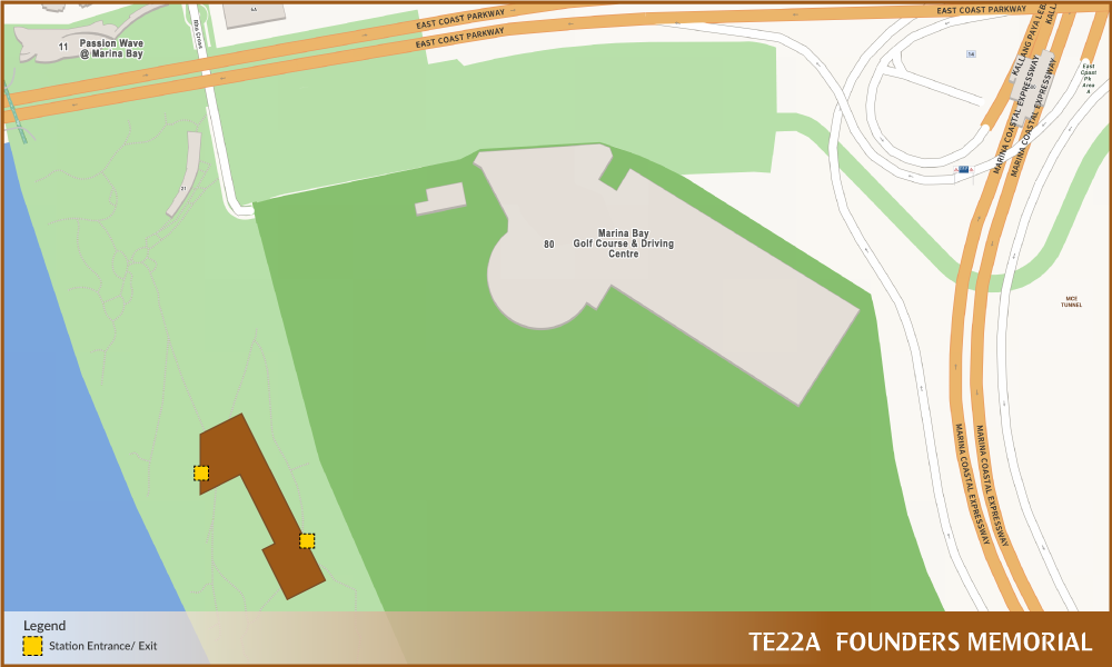
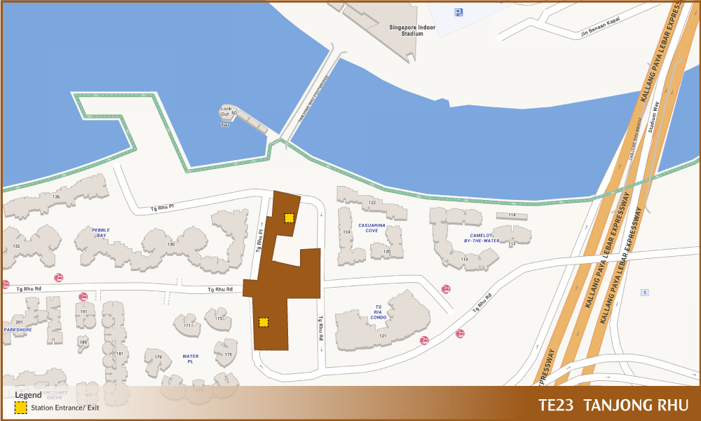
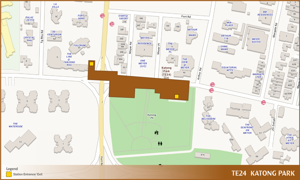
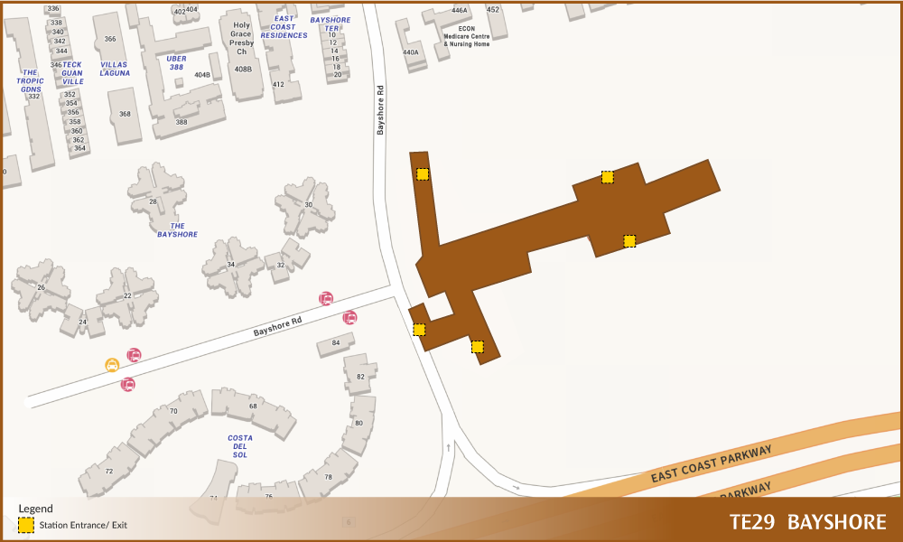
Creating Exits/Entry point
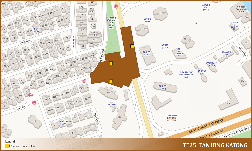
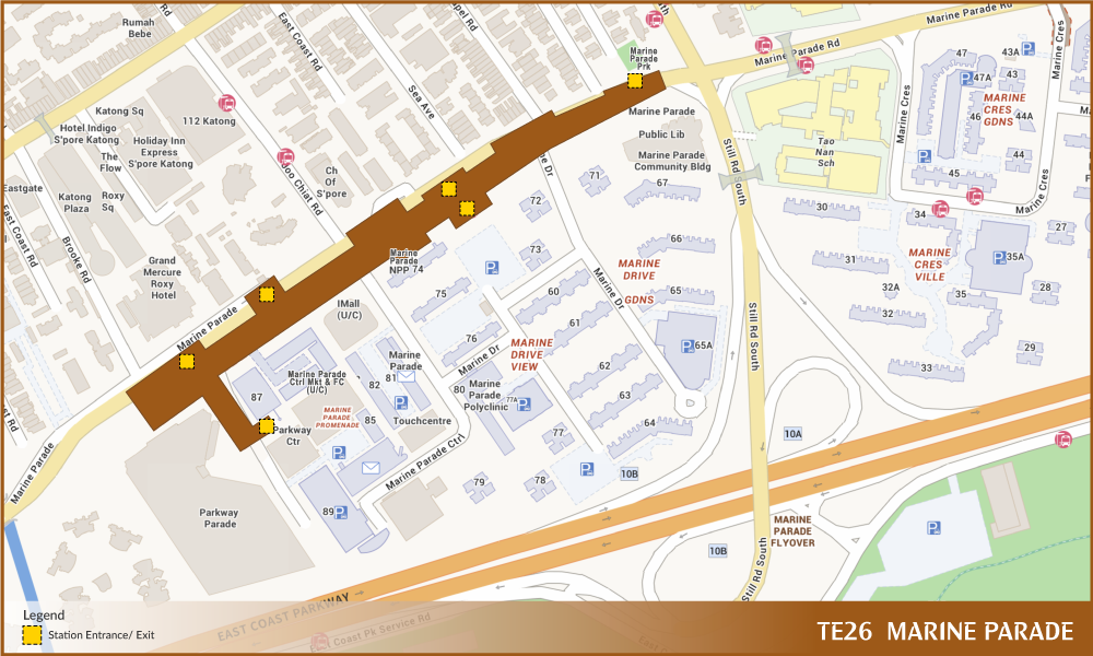
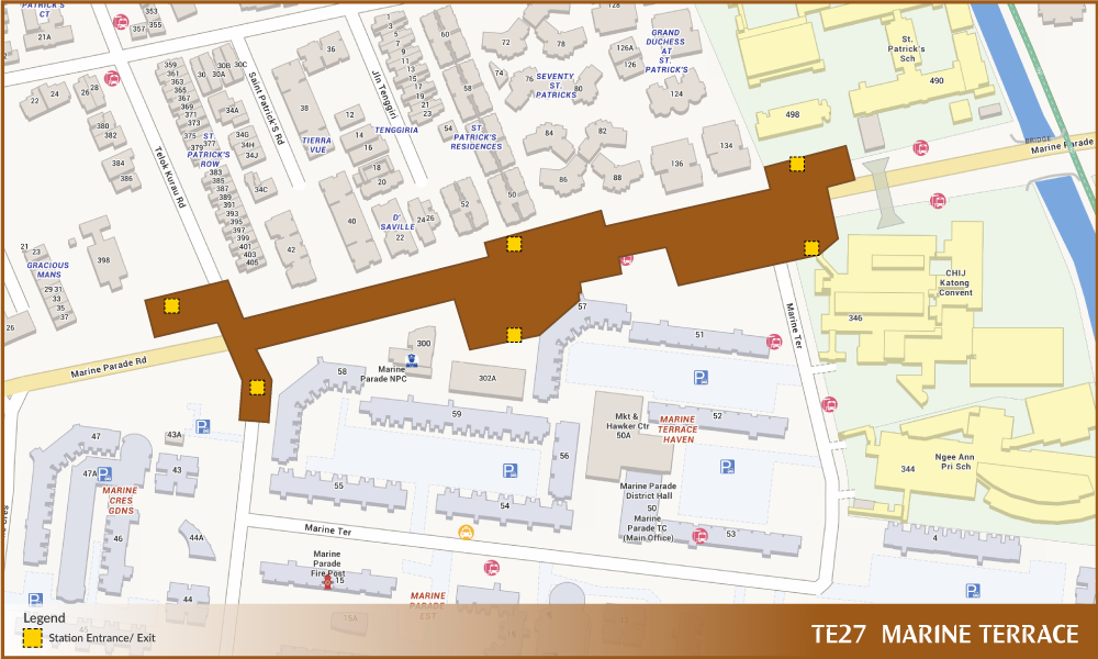
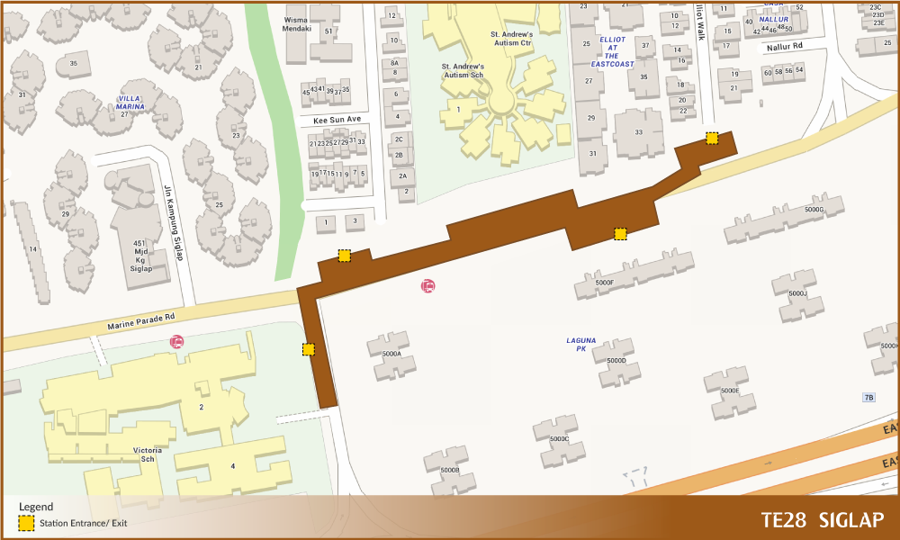
Since the newly TEL stage 4 does not have an exit/entry point layer, manual creation is required with reference to Land Transport Authority’s (LTA) design plan as shown in the figures below:
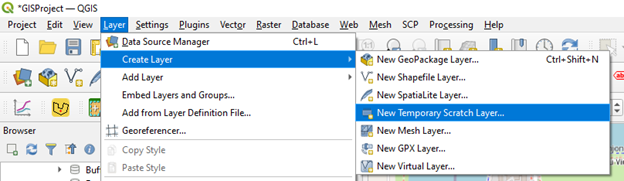
One approach is to create a “New Temporary Scratch Layer”. Firstly, on the menu bar, click on Layer >>> Create Layer >>> New Temporary Scratch Layer.
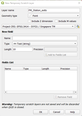
A new pop-up screen will be shown. Rename the layer name according to the naming convention of “station name_ Station_exits”. Then, change the geometry type to Points as well as the projection system as shown below. Leave the rest as default and click on OK.
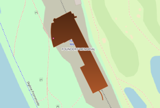
A temporary new layer will be added in the Layers tab. On the menu bar select Toggle edit button and select Add Points Feature.

Navigate to the FM station and click on the station and a point should be created as shown below. This approach would allow us to create the station exits/entry for all 8 stations.
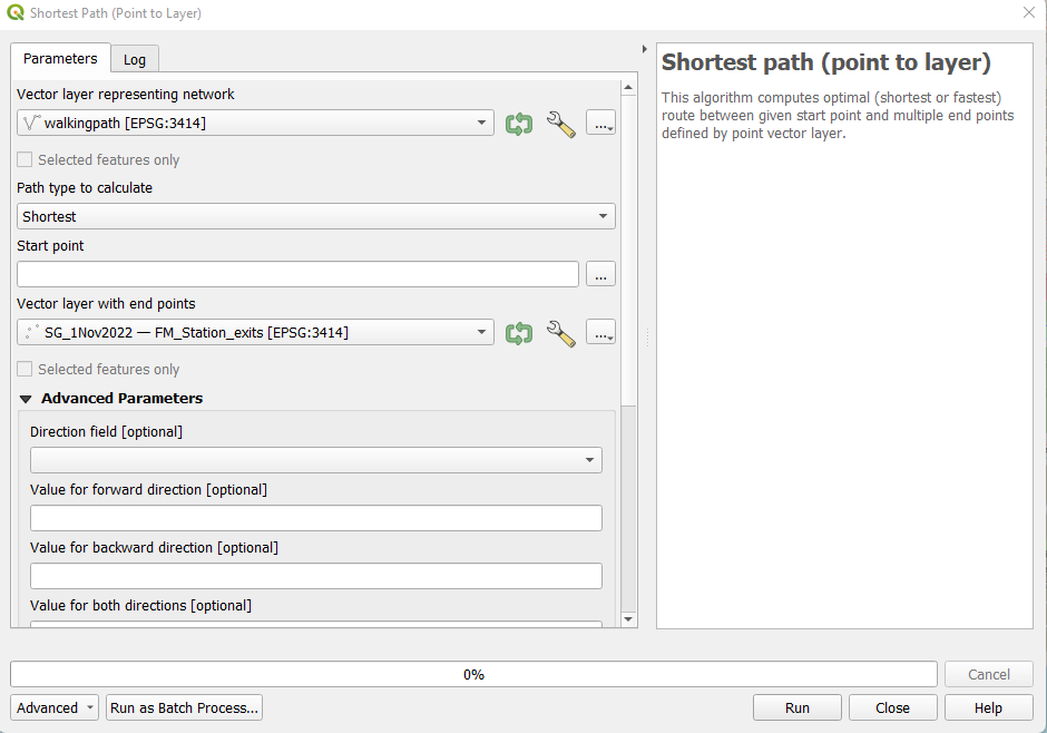
Shortest Distance
Each station's amenities and points of interest within a 10-minute walk from the stations’ exit points have been examined. The shortest distance for each of the 8 stations’ entry/exits points have been determined using network analysis of the Shortest Path (point to layer) and the extracted walking path layer.
|
|